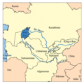
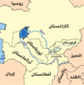
Faýl:Aral map.png
Aral_map.png (279 × 281 piksel, faýlyň ölçegi: 19 KB, MIME tipli: image/png)
Faýlyň taryhy
Faýlyň geçmişini görmek üçin Sene/Wagt bölümündäki senelere tyklaň.
| Sene/Wagt | Miniatýura | Ölçegler | Ulanyjy | Teswir | |
|---|---|---|---|---|---|
| häzirki | 17:41, 9 aprel 2008 |  | 279 × 281 (19 KB) | Claus Obana | |
| 14:02, 22 ýanwar 2007 |  | 300 × 300 (18 KB) | Kmusser | added label for Naryn River | |
| 18:52, 16 noýabr 2005 |  | 300 × 300 (16 KB) | Kmusser | ||
| 18:33, 16 noýabr 2005 |  | 300 × 300 (65 KB) | Kmusser | This is a map of area around the Aral Sea including the Amu Darya and Syr Darya rivers. I, Karl Musser, created it based on USGS data. The Aral Sea b |
Faýlyň ulanylyşy
Bu faýla çykgydy bar bolan sahypa:
Global faýl ulanyşy
Bu faýl aşakdaky beýleki wikiler tarapyndan ulanylýar:
- af.wikipedia.org sahypasynda ulanyş
- ar.wikipedia.org sahypasynda ulanyş
- arz.wikipedia.org sahypasynda ulanyş
- ast.wikipedia.org sahypasynda ulanyş
- az.wikipedia.org sahypasynda ulanyş
- ba.wikipedia.org sahypasynda ulanyş
- be-tarask.wikipedia.org sahypasynda ulanyş
- be.wikipedia.org sahypasynda ulanyş
- bg.wikipedia.org sahypasynda ulanyş
- br.wikipedia.org sahypasynda ulanyş
- ca.wikipedia.org sahypasynda ulanyş
- ceb.wikipedia.org sahypasynda ulanyş
- cs.wikipedia.org sahypasynda ulanyş
- cv.wikipedia.org sahypasynda ulanyş
- cy.wikipedia.org sahypasynda ulanyş
- da.wikipedia.org sahypasynda ulanyş
- de.wikipedia.org sahypasynda ulanyş
- diq.wikipedia.org sahypasynda ulanyş
- el.wikipedia.org sahypasynda ulanyş
- en.wikipedia.org sahypasynda ulanyş
- en.wiktionary.org sahypasynda ulanyş
- eo.wikipedia.org sahypasynda ulanyş
- es.wikipedia.org sahypasynda ulanyş
- eu.wikipedia.org sahypasynda ulanyş
- fa.wikipedia.org sahypasynda ulanyş
- fi.wikipedia.org sahypasynda ulanyş
Bu faýlyň global ulanyşyny görkez.


