Faýl:MughalEmpire1700.svg

Size of this PNG preview of this SVG file: 800 × 467 piksel. Other resolutions: 320 × 187 piksel | 640 × 374 piksel | 1 024 × 598 piksel | 1 280 × 748 piksel | 2 560 × 1 495 piksel | 2 568 × 1 500 piksel.
Original faýl (SVG faýly, nominal 2 568 × 1 500 piksel, faýl ölçegi: 147 KB)
| Düşündiriş |
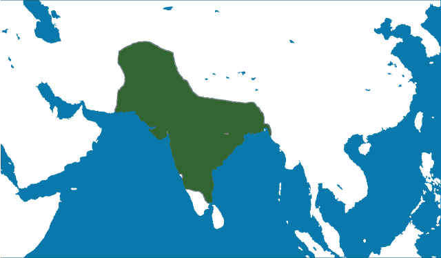
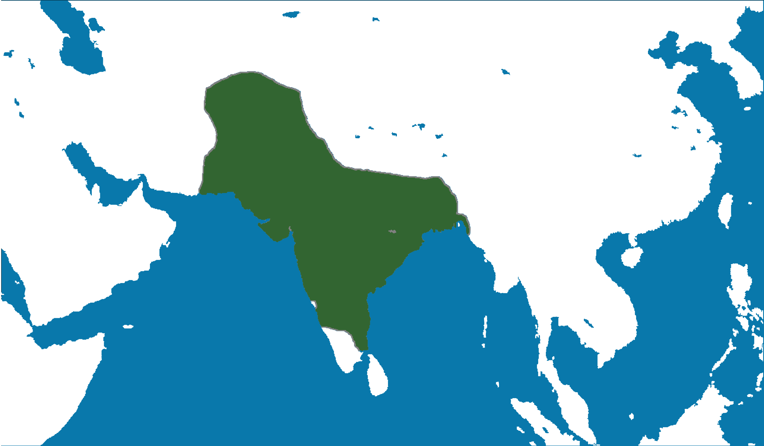
English: Locator map of the Mughal Empire, c. 1700.
(Partially based on Atlas of World History (2007) - The World 1600-1700, map) |
|||
| Sene | ||||
| Çeşme | Öz işi (eseri) | |||
| Awtor | nafSadh | |||
| Rugsat (Bu faýly täzeden ulanmaklyk) |
I, the copyright holder of this work, hereby publish it under the following license:
|
Faýlyň taryhy
Faýlyň geçmişini görmek üçin Sene/Wagt bölümündäki senelere tyklaň.
| Sene/Wagt | Miniatýura | Ölçegler | Ulanyjy | Teswir | |
|---|---|---|---|---|---|
| häzirki | 15:27, 8 iýun 2011 | | 2 568 × 1 500 (147 KB) | Nafsadh | Mughal Empire in 1700 CE. |
Faýlyň ulanylyşy
Bu faýla çykgydy bar bolan sahypa:
Global faýl ulanyşy
Bu faýl aşakdaky beýleki wikiler tarapyndan ulanylýar:
- ast.wikipedia.org sahypasynda ulanyş
- bg.wikipedia.org sahypasynda ulanyş
- bn.wikipedia.org sahypasynda ulanyş
- ca.wikipedia.org sahypasynda ulanyş
- cs.wikipedia.org sahypasynda ulanyş
- cy.wikipedia.org sahypasynda ulanyş
- en.wikipedia.org sahypasynda ulanyş
- es.wikipedia.org sahypasynda ulanyş
- eu.wikipedia.org sahypasynda ulanyş
- ga.wikipedia.org sahypasynda ulanyş
- gl.wikipedia.org sahypasynda ulanyş
- ha.wikipedia.org sahypasynda ulanyş
- hi.wikipedia.org sahypasynda ulanyş
- hr.wikipedia.org sahypasynda ulanyş
- io.wikipedia.org sahypasynda ulanyş
- ja.wikipedia.org sahypasynda ulanyş
- kab.wikipedia.org sahypasynda ulanyş
- lv.wikipedia.org sahypasynda ulanyş
- ms.wikipedia.org sahypasynda ulanyş
- pnb.wikipedia.org sahypasynda ulanyş
- sh.wikipedia.org sahypasynda ulanyş
- ta.wikipedia.org sahypasynda ulanyş
- uk.wikipedia.org sahypasynda ulanyş
- vi.wikipedia.org sahypasynda ulanyş
- www.wikidata.org sahypasynda ulanyş